
Sycamore Trail
Trail Location:

William B. Umstead State Park | Raleigh, NC
Trail Distance:
7.2 miles (out & back)
Trail Difficulty:
Moderate
Elevation profile & map >>
See the Umstead park map >>
Moving along...
As you'll see on the park map, the Sycamore Trail follows a lollipop-style route from the northern section of the park, just south of the visitor's center. The trail eventually takes you past Sycamore lake and along Sycamore Creek before leading you back to the trail head.
 Creating your own mish-mash of a trail run by including other Umstead trails on your route is simple, because Sycamore intersects other traveling paths at a couple of great points. There's the Pott's Branch loop, which is short but nice when you want to tack on a couple more miles for the day. Or, you could hop onto the bridle trail and skip over to Company Mill for a decent long run. There are so many possibilities.
 If you're like most park visitors, you'll enter Sycamore Trail from the North. From there, the trail begins with a quick descent and a couple of switchbacks before leading you to a bit of flatness along the creek. You'll cross the park road and continue along a wider, somewhat technical path with lots of pine needles under foot. The section gradually becomes more technical with roots and rocks testing your agility. And, the hills become a bit more intense, too.

 Whichever direction you choose to go, the terrain will be splendid. There are areas with plenty of rocks and roots and areas that let you take it easy for a while. There are hills. There are scenic flat pathways along the creek. There are certain spots that never seem to be free of mud. Sycamore does not disappoint.
Eventually, you'll find yourself approaching that familiar parking lot sign that marks the split in the trail. You've completed the circular portion of the course. And, now, you get to return along the same route on which you started with a different perspective. Depending on your level of expectations, you may or may not be glad to know that the toughest hills are behind you.
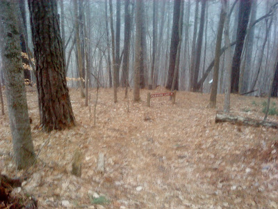
Apologies for the poor quality of these photos. It was starting to snow and sleet at the time.
My Favorite Features of the Sycamore Trail:
- Rocky hills for ascending and descending
- multiple switchbacks along hill sides
- Contrast between flat, easy terrain and challenging, technical footing.
- Most everything else
Features I Dislike:
- 1 bridge with stairs
Getting There
You'll want to enter Umstead via the Umstead Parkway entrance off Hwy 70 (aka Glenwood Avenue). Follow the parkway to the end of the road, which will end in a parking lot. You'll pass the visitor's center and another parking lot on your way there. Don't be tempted to pull into the first parking lot you see. Go all the way to the end of the road.Get out of your car and head east from the parking lot to the paved path that curves away, forming a circle, toward a couple of picnic buildings. Continue east for a few more meters until you reach the largest covered building. The Sycamore Trail Head will be to the left of it. Start runnin'!
This is important: If you need to use the restroom before starting your run, backtrack away from the trail head and make a right at the paved path's intersection. The restroom is between the parking lot in which you parked and the other one you saw on your way down the parkway. It's not far, just inconspicuous.
If you find yourself heading toward Umstead on Ebenezer Church Rd., it appears that you could access the Sycamore Trail by turning west onto Graylyn Dr. Follow it to a parking lot somewhere in the middle of the trail's out-and-back portion. I wouldn't want to park here, though, because I'd feel like I was starting the run in the middle. It'd feel less complete this way, don't you think?

Summary
If you've already perused my other reviews of Umstead trails, you might be tired of reading the same thing: This trail is great. I love it. Umstead is awesome.Well, I approach a trail run from a conceptual perspective. And, being the positive fellow that I am, I am often hard pressed to find fault with any trail in the woods. Perhaps this is due to my lack of experience. Yet, as redundant as my Umstead review series is, you should be glad to know that it's hard to choose a bad trail there.
So, Sycamore is the longer trail. And, for that reason, I think it offers just a smidgen more of an Umstead experience to the runner than the other two major technical trails (Loblolly and Company Mill) in the park.
I mean, there's no reason you shouldn't run every trail in Umstead. But, if you're in Raleigh for a day with time for just one trail run, choose to run on the Sycamore Trail.
The Sycamore Trail elevation profile.
Check out an interactive map, too >>


Once again, great review.
ReplyDeleteThough I am curious why you don't like the steps and bridges.
I like them because they are a good challenge to keeping your momentum going, just like a fallen log or big rocks.
Plus, they show up in trail races a lot, so it is good practice!
Another nice review! And I also agree that Sycamore may be the nicest of the trails.
ReplyDeleteIf you live closer to the Harrison Ave. entrance, a nice run is to do the company mill plus the sycamore loop (it makes a figure-8 shape and comes in at about 8.7 miles).
AC: You make a good point about the steps with bridges being good practice for sustaining momentum. I should be more appreciative of the challenge they impose.
ReplyDeleteGarth: That's a great combination of the Sycamore and Company Mill trails. I work near the Harrison Ave. entrance. So, one day, when I have the time, I'll be sure to give it a try!
Nice review. I tried to run it yesterday and failed. I completed it 60% run and 40% walk at the end. I wouldn't call it moderate. It is at least 4 times tougher than Sal's branch trail. Sal's has been my favorite so far but it has become very friendly to me. So it will be Sycamore for me for a long time. It is surely a challenge.
ReplyDeleteThe trial markings are confusing. One can easily get lost for some time.
Thanks for the comment, Ramana/Vasu! Would you believe I still haven't made it over to Sal's Branch trail for a run? Now you've really got me interested.
DeleteTrying Sycamore for the first time in the heat of the Summer is definitely a challenge. Combining a "moderate" trail with extreme heat and humidity is rough! I'd have walked it, too.
Hello Ashwyn, just completed Sycamore trail in my third attempt. Nice feeling but poor timing. This is my first greater than 5 miles run!
DeleteGreat post thankyyou
ReplyDelete